Directions
when Traveling
to Glencolmcille, Donegal
Location and Travel Conditions
Glencolmcille is on the rugged west coast of Donegal, approximately 50
minutes’ drive
from Donegal Town or 25 minutes from Killybegs. The Folk
Village Museum is
a 2 minute drive or 10 minute walk along the coast road from the centre of
Glencolmcille village (known as ‘Cashel’).
 Transport
options in Donegal are private vehicle or bus. The fresh air and the
beauty of the landscape will also reward the cyclist or walker.
The more
remote rural roads in western Donegal can be hilly, windy, bumpy or dotted
with resting sheep – but they are always extraordinarily scenic.
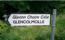
Road signs are lettered in both English and Irish, and sometimes only
in Irish. Explore the beauty of Glencolmcille click
here.


Satellite GPS coordinates are:
North 54 degrees 42.446' minutes
West 8 degrees 44.429' minutes
Location Map
Use the zoom / pan controls on the map!
View Glencolmcille Folk Village in a larger map
Travel times by car from Airports
Donegal Airport 1h 20m
Derry Airport 2h
Knock West of Ireland Airport 2h 30m
Belfast Airport 3h 30m
Dublin Airport 4h
Public Transport
There are daily buses to/from Glencolmcille from local towns such as Dungloe
to the north and Donegal Town to the east. These towns have regular connections
to larger towns and cities, such as Letterkenny, Derry, Sligo, Galway and
Dublin. The nearest rail
connections are in Derry or Sligo.
Check the website of Ireland’s national bus company, www.buseireann.ie, for
route information, up-to-date timetables and online bookings. Tourist
offices throughout Ireland can also help you plan your bus journey to Glencolmcille.


